
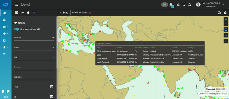
The Vessel Position module provides real-time insights into vessel locations and historical routes. It offers advanced functionalities such as map filtering and distance measurement, which sets a new standard for navigation and operational planning.
The Vessel Position module manages diverse map layers, including weather conditions, piracy alerts, and global Automatic Identification System (AIS) data, alongside offering role-based KPIs and map visualizations for targeted decision-making.
Key Features
- Real-time tracking of current and historical vessel positions
- Advanced map filtering and visualizations for detailed route analysis
- Visualization of areas on the map
Benefits
- Enhance situational awareness and navigational safety
- Boost operational efficiency and optimize route planning
- Enable proactive risk management with customizable alerts